The Landscape
of Maker Heights
The Landscape of Maker Heights
Maker Heights is located at the highest point of the Rame Peninsula and enjoys wonderful views of the surrounding land, sea and sky. The site is rich in natural and human histories. It is a place where a unique combination of heritage assets offers enjoyment and inspiration.

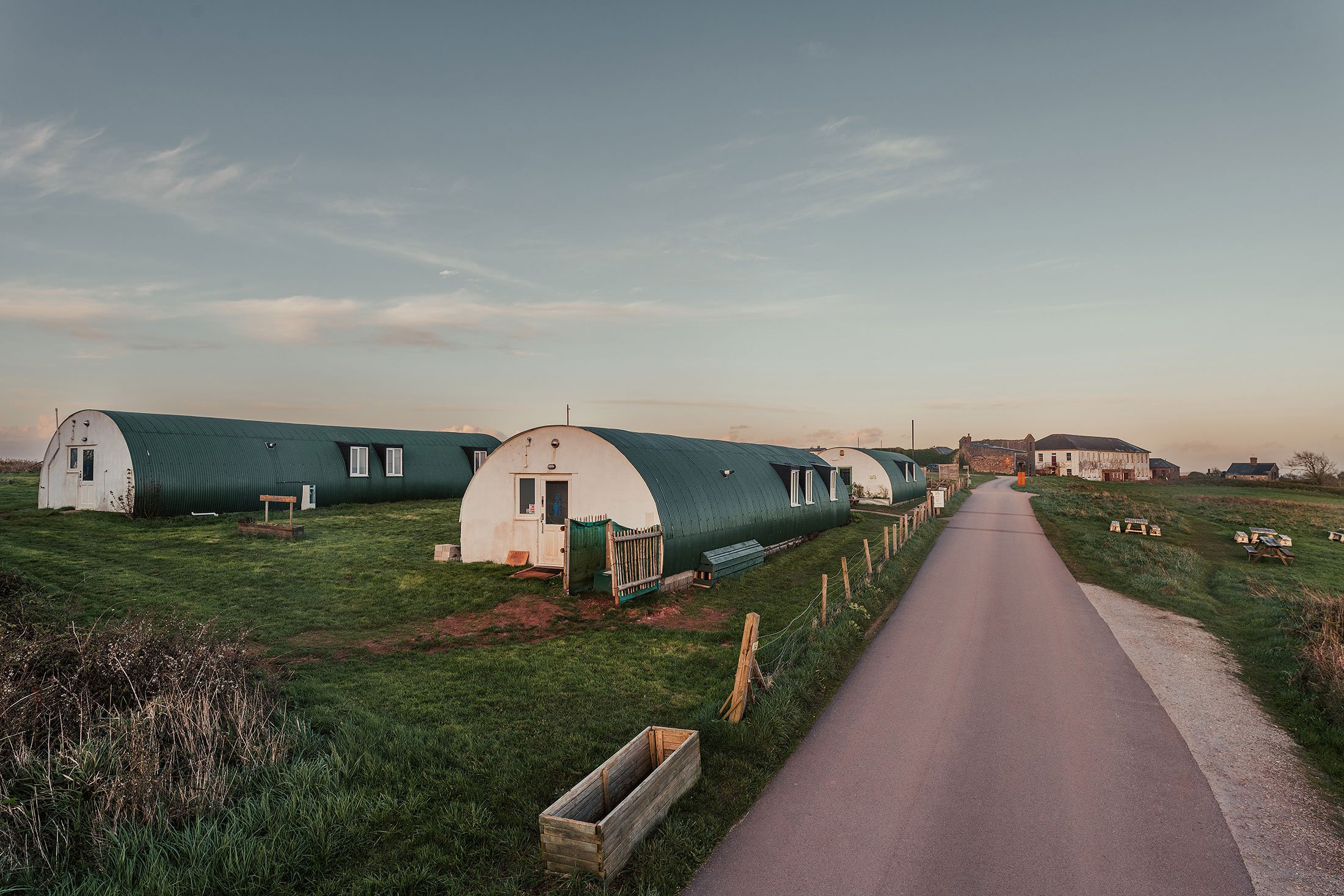
At least 96% of the site is greenspace – where the soil, water and plant communities combine to create diverse natural systems. In addition, the place has been shaped by centuries of human history. Maker Heights includes extensive archaeology, beginning in the Mesolithic period, and many historic buildings. The Conservation Management Plan for Maker Heights describes the historic landscape of the place.
The landscape of the Rame Peninsula is so valued and enjoyed it is protected as part of the Cornwall National Landscape. Section 11 of the Cornwall National Landscape includes Maker Heights, Rame Head, Mount Edgcumbe Country Park and the villages of Cawsand and Kingsand.
National Landscapes are protected landscapes whose distinctive character and natural beauty are so outstanding that it is in the nation’s interest to safeguard them. As such they have been nationally designated by the same legislation as National Parks and have the same status and level of protection. The primary purpose of the National Landscape designation is to conserve and enhance natural beauty.

At its best, nature is well connected, abundant and diverse, and these qualities endow the resulting landscape with natural beauty. Connectedness, abundance and diversity also result in ecosystems that are species-rich, complex and resilient. These qualities are in contrast to the landscapes created by industrialised agriculture – modern field systems tend to be species-poor and lacking in both complexity and wildlife. The combined effects of industrialised agriculture and climate change can be detrimental to our countryside; soil loss, for example, is widespread. Resilient landscapes are better able to resist deterioration. Nowadays, Maker Heights can be seen as a rare island of richness and diversity in a sea of industrialised agriculture.
The rich natural history of Maker Heights is determined, in large part, by the physical geography of the area – the unique combination of landform, climate and geology. These, in turn, give rise to a wide range of habitats.
The permanent species-rich grasslands at Maker are an important, and nowadays increasingly rare, feature of the landscape. The meadows contribute to species-rich areas of scrub (a mosaic of intermediate stages between woodland and grassland) - another valuable habitat which is becoming increasingly rare in our countryside. Other valuable habitats at Maker include mixed woodland, hedgerows, a variety of buildings in stone, brick and concrete, walls, banks, ditches and quarries. All offer a wide range of niches for plants and animals, large and small.
During spring, summer and autumn the flowing meadows, packed with native flowers, are a wonderful sight - rarely seen in the modern countryside. They range from the tussocky grassland that is rarely, if ever, cut (it provides many homes for small mammals) to the mosaiced meadows of the campsite. In contrast, the small green spaces in front of the Barrack Block harbour bee orchids with their extraordinary flowers of mimicry which can been seen in June.

The central grassy area is used as a campsite for six months of the year, and the mowing of camping pitches contributes to mosaicing the meadows. Around the edges of the campsite are areas of scrub and these provide another valuable habitat. The combination of meadow and scrub greatly increases diversity – scrub shelters the meadows making them more attractive to insects and, in turn, the grassland provides insect and seed food for birds nesting in the scrub.
The rare cirl bunting has previously been recorded from Maker Heights (along Earl’s Drive) and it relies particularly on scrub/grass mosaics. It needs dense patches of gorse, blackthorn and bramble scrub for nesting but requires these to be within 200m of tussocky grassland containing its insect food. In addition, skylarks can be seen (and heard!) at Maker Heights. Skylarks are ground-nesting and need similarly thoughtful management if they are to achieve breeding success.
The Rame Conservation Trust is responsible for most of the site and, through careful management, it works to conserve wildlife and enhance the site’s habitats. The Trust work in accordance with the Conservation Management Plan and the guidance of Historic England and Cornwall Wildlife Trust.
Connectivity is very much the theme of the Trust’s work – connecting not only stakeholders but also Maker Heights with its surrounds. The north-south hedgerow on the eastern side of the site provides an important wildlife corridor and a flight line for bats and birds. Migrating birds, in particular, use the corridor in spring and autumn as part of their migratory routes, via Rame Head, from and to Europe. The Trust are is working to improve the wildlife corridor by filling in gaps and minimising disturbance.
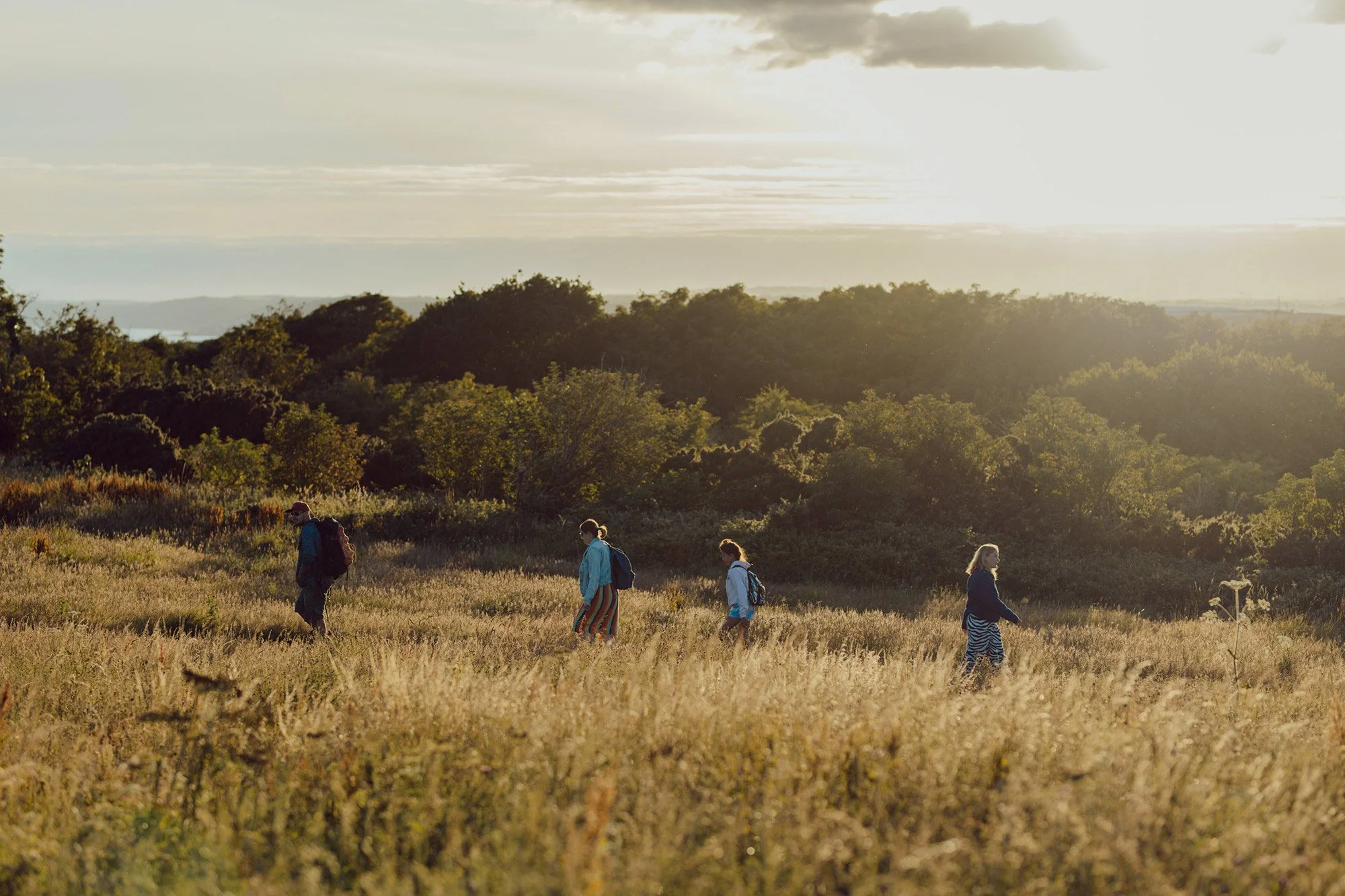
As with all charities, our pupose is to create public benefit. Public access is key at Maker Heights. Public access ensures that visitors can experience, enjoy and learn about the place and benefit from all the activities that contribute to health and wellbeing. These include opportunities to interact with nature - there is growing evidence that walking in natural surroundings can promote health and wellbeing.
Walking along the footpath (Public Right of Way) across Maker Heights enables a visitor to experience many of the wildlife habitats described above. From the north end, one can explore Redoubt No. 1, walk alongside the uncut tussocky meadow between the Nissen Hut complex and Barrack Block – and an undisturbed area which is so important for late flowering plants and small mammals – past the Barrack Block with its small green areas where bee orchids flourish. Following the old military route southward, we can explore Redoubt No. 3 and then return to the Soldier’s Path down to Earl’s Drive and on to the impressive frontage of Redoubt No. 4/Grenville Battery.